The New Standard for Unmanned Services in Statesboro
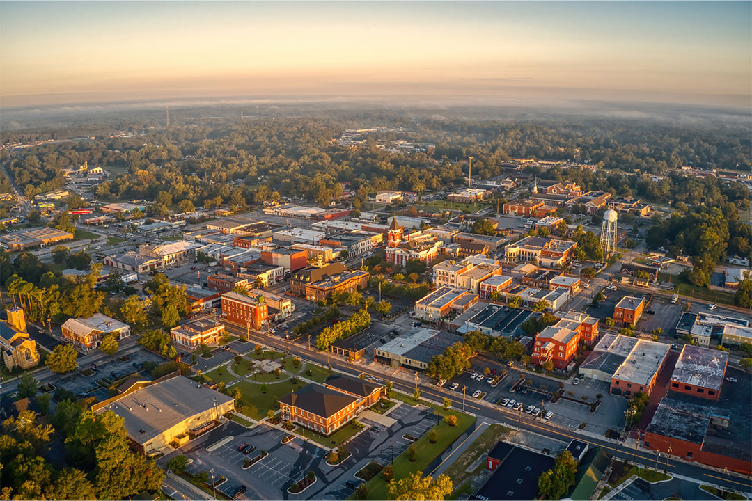
Welcome to the Statesboro regional headquarters of Fair Lifts Unmanned Aerial Services. In a community defined by the hardworking spirit of the Georgia Coastal Plain, we believe that the integration of high-level technology and localized expertise is the only path forward for a resilient economy. Statesboro is more than just a college town or a transit hub; it is the heartbeat of Bulloch County’s agricultural and industrial sectors. From the vast cotton fields of Brooklet to the expanding manufacturing corridors near I-16, Fair Lifts provides the technical backbone that allows regional businesses to scale, compete, and succeed.
Our approach is built on a simple but powerful premise: data must be actionable. For too long, "drone services" have been viewed as a novelty consisting of aerial photos that look impressive but offer little in the way of operational ROI. Fair Lifts is changing that narrative. We represent the shift from unmanned aerial vehicles (UAVs) as toys to UAVs as critical infrastructure tools. Our heritage is rooted in aviation safety and rigorous project management, ensuring that every mission we fly for a Statesboro client is executed with military-grade precision and a deep understanding of the local environment.
Deeply Rooted in Bulloch County’s Soil
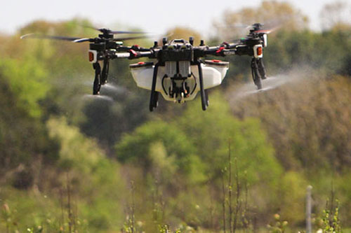
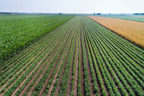
Agriculture is the literal foundation of Statesboro. Our regional growers manage some of the most productive cotton, peanut, and pecan acreage in the United States. However, the sandy soils and humid climate of the Coastal Plain present unique challenges. Heavy summer rains in Bulloch County can turn fields into impassable mud in minutes, leaving ground-based sprayers stuck in the shed while disease pressure mounts. This is where Fair Lifts excels. We are the "Access Experts." Our fleet of heavy-lift application drones flies when tractors cannot, ensuring that late-season fungicides reach the corn tassels and peanut canopies exactly when the moisture window demands it.
Beyond the field, we are committed to the stewardship of South Georgia's natural resources. The Ogeechee River basin is a vital ecological artery, and its protection requires a delicate touch. Our environmental division specializes in the surgical elimination of invasive species like Cogongrass and Phragmites without the soil compaction or habitat disturbance caused by traditional ground crews. By utilizing survey-grade multispectral data, we can delineate infestations with centimeter accuracy, ensuring that our herbicide applications are as effective as they are responsible. We aren't just working in Statesboro; we are working for Statesboro's future.
Engineering-Grade Geospatial Intelligence
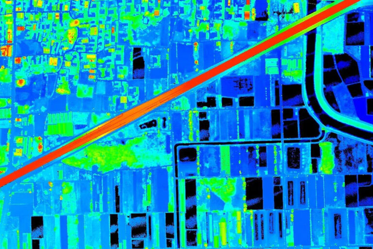
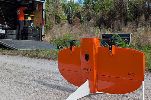
As Statesboro expands, so does the demand for accurate, rapid geospatial data. Whether it is a new industrial park development near Georgia Southern University or a critical infrastructure inspection for regional power utilities, the margin for error is non-existent. Fair Lifts Survey & Mapping Services delivers the absolute vertical and horizontal accuracy that engineering projects require. By utilizing Blue UAS certified platforms like the WingtraOne Gen II and Riegl miniVUX LiDAR sensors, we capture millions of data points through even the thickest Georgia timber canopy.
Our commitment to Statesboro extends to the security of our data. In an era of increasing cybersecurity threats, we prioritize the protection of regional infrastructure information. Our Blue UAS certification is a testament to our adherence to Department of Defense standards for supply chain integrity and data encryption. When we map a Bulloch County pipeline or substation, your sensitive asset data is protected from collection to delivery. We provide more than just maps; we provide the peace of mind that comes with professional, secure geospatial intelligence.
We invite you to explore our specialized services and see how Fair Lifts is transforming the skyline and the bottom line of Statesboro, GA. Our team of expert project managers, agronomists, and pilots is ready to consult on your next large-scale challenge. Because in Bulloch County, we don't just accept the challenge; we conquer it from above.
Regional Impact
Local Mobilization
Our regional crew is stationed locally, providing sub-24 hour response times for Bulloch County, Candler, Screven, and Evans counties.
Request Local Response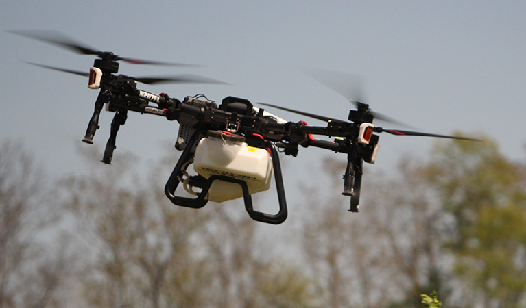
Ready to Start Your Project?
Discuss your specific goals in Statesboro with a regional expert. We provide rapid mobilization and precision scoping for every regional client.